
|
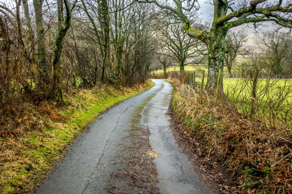
Start from High Swinside cattlegrid
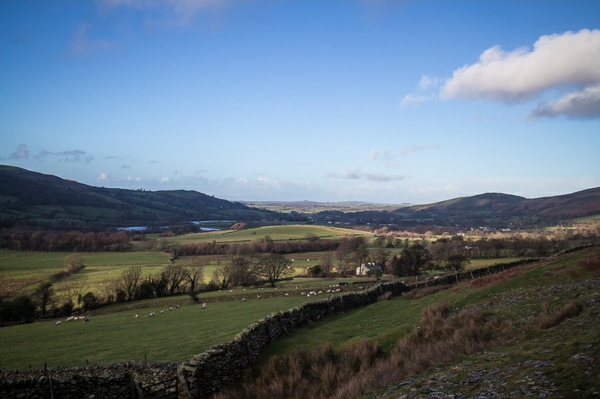
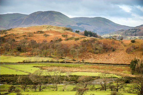
Leave High Swinside from the cattlegrid and walk south on the track then the road along the valley side with fine views ahead and across the valley. This photo is taken looking back northwards towards the Solway plain.
Take footpath before the road gate
Take the first footpath on the left which comes near a parking place and shortly before the gate across the road. Where the path divides, keep right so that you stay near the wall on your right. You cross Hope Beck and will soon be walking along the side of the Dodd with it rising steeply on your left.
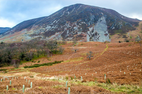
Contour along the valley side
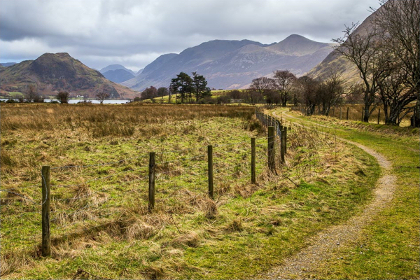
Continue along this path, contouring along the valley side with Low Fell off to your right across the valley and views of Melbreak ahead of you as you round the Dodd. This path takes you right down the valley to Liza Beck. When the wall curves away downhill, follow it for a short way around the bend, then take the path that heads away from it on the level through the bracken to Liza Beck. Lanthwaite Hill is in the middle of the valley to the right with Carling Knott in view behind - beyond Loweswater.
Cross Liza Beck
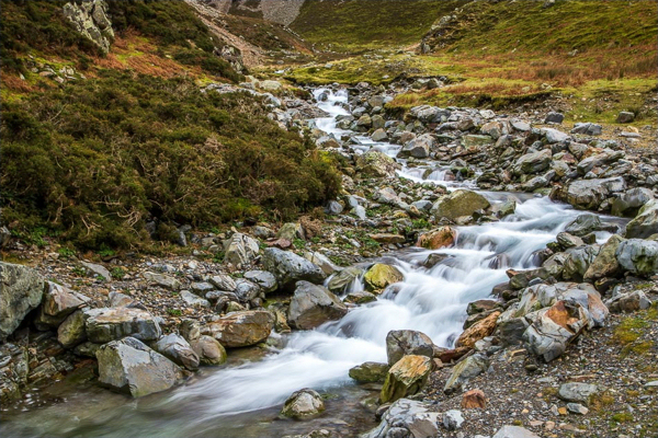
Liza Beck cuts down the impressive Gasgale Gill valley. There is a footbridge here (damaged by storm Desmond, so if not yet repaired you might have to use stepping stones a little higher up the stream). Cross the stream then take the path downhill to the road and Lanthwaite Farm.
Head for Lanthwaite Wood
On the far side of the road this footpath will take you to Lanthwaite Wood. Shortly after entering the wood take a footpath on your left which curves around and downhill to bring you to the shore of Crummock Water near the boathouse. Turn right along the shore past the boat house.
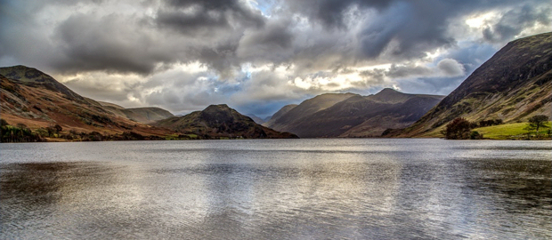
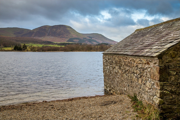
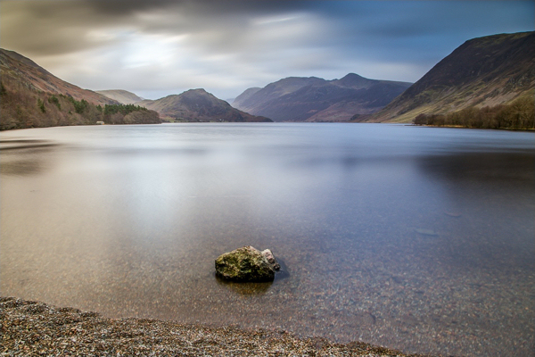
Walk beside Crummock Water
This is a beautiful lake at any time, but Andrew Locking's photos here are scrumptious!
Cross the River Cocker at the weir...
Keep next to the shore as it curves around and cross the footbridge at the weir where the River Cocker exits the lake. The view up the lake from here is stunning with Rannerdale Knotts on the left, Melbreak to the right, and the High Stile range in the distance beyond...
Take footpath to Muncaster House
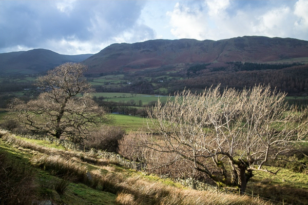
Cross another footbridge, this time over Park Beck carrying the outflow from Loweswater, and just before the shore bulges out into the lake, turn right along a path away from the water. Almost immediately, turn right again and shortly you will recross Park Beck as you now head towards Muncaster House. (This photo is looking back towards Crummock Water along that track).
Turn right over Scale Bridge
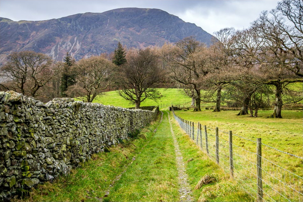
Your track joins a lane. Turn right here past Muncaster House and continue on to the Loweswater road near Scale Bridge. Turn right and walk over Scale Bridge. Take the first footpath into the woods on the right after the crossing the bridge.
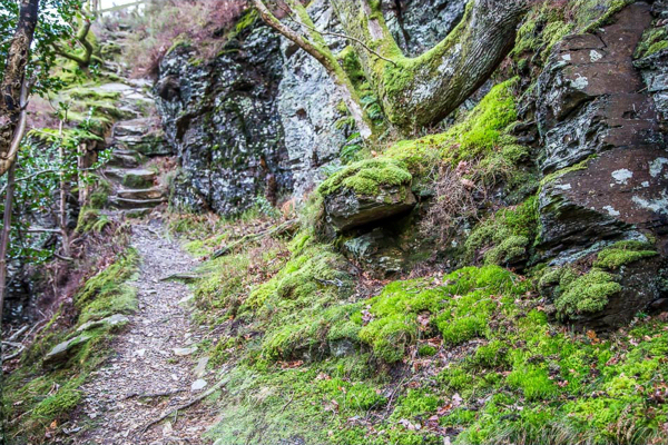
Enter the woods and keep up the hill
Your way is now a zig zag up the hill, turning left at the first junction, then left again, then right - always upwards. The way is quite steep for a short while with stone steps.
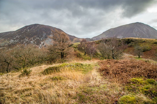
Climb to the top of the hill
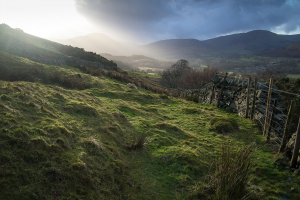
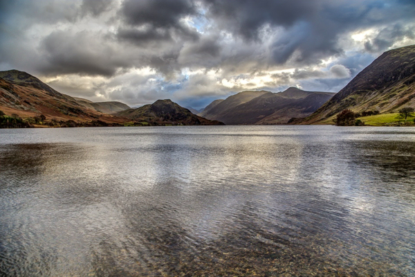
Your path emerges into the open and you can walk ahead towards the top of the hill with Whiteside and Grasmoor showing beyond. The path curves around to the highest point where the views through 360 degrees are very special.
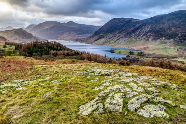
Stunning 360 degree views!
The view ahead at this point is over Crummock Water with Rannerdale Knotts, the High Stile Range and Melbreak all in view. In fact you can see as far as Great Gable... To the right, Loweswater is just visible, while behind you lie Low Fell and the Lorton valley. Whiteside and Grasmoor look down on it all from the left...
Return to the main path
When you've finished enjoying the views, return to the main path where you first emerged into the open and turn right so that you are descending northwards towards Lorton valley.
Return to High Swinside on quiet lanes
Leaving Lanthwaite Hill, you reach a footpath T-junction near Palacehow and turn right towards the B5289. Here you turn left along the B5289 for a short while, leaving it just beyond Low House to take the Millers Place bridle path. At High Hollins take the right hand path to Millers Place. At Millers Place you have a choice to turn right up the outgang and regain the morning's footpath, or continue to Hopebeck along the lane and turn right there, signposted 'Gated road'. Either way will bring you back to High Swinside after a day of glorious views! |
||||||||||||||||||
|
|
|||||||||||||||||||
Crummock Water & Lanthwaite Hill
This walk heads south from High Swinside along the valley side with views to Melbreak ahead and Low Fell across the valley. It includes a lovely section along the shore of Crummock Water before returning through Lanthwaite Woods and up onto Lanthwaite Hill (marked Scale Hill on some maps). The views from this low summit are some of the best in the western lakes. The final leg is mainly on quiet lanes winding through the Lorton valley back to High Swinside.
This walk heads south from High Swinside along the valley side with views to Melbreak ahead and Low Fell across the valley. It includes a lovely section along the shore of Crummock Water before returning through Lanthwaite Woods and up onto Lanthwaite Hill (marked Scale Hill on some maps). The views from this low summit are some of the best in the western lakes. The final leg is mainly on quiet lanes winding through the Lorton valley back to High Swinside.
- Just over 8 miles in length
- 540 metres of ascent and descent
- Ascent onto Lanthwaite Hill is steep in places
|
|
Start from High Swinside cattlegrid
Leave High Swinside from the cattlegrid and walk south on the track then the road along the valley side with fine views ahead and across the valley. This photo is taken looking back northwards towards the Solway plain.
Take footpath before the road gate
Take the first footpath on the left which comes near a parking place and shortly before the gate across the road. Where the path divides, keep right so that you stay near the wall on your right. You cross Hope Beck and will soon be walking along the side of the Dodd with it rising steeply on your left.
Contour along the valley side
Continue along this path, contouring along the valley side with Low Fell off to your right across the valley and views of Melbreak ahead of you as you round the Dodd. This path takes you right down the valley to Liza Beck.
When the wall curves away downhill, follow it for a short way around the bend, then take the path that heads away from it on the level through the bracken to Liza Beck.
Lanthwaite Hill is in the middle of the valley to the right with Carling Knott in view behind - beyond Loweswater.
Cross Liza Beck
Liza Beck cuts down the impressive Gasgale Gill valley. There is a footbridge here (damaged by storm Desmond, so if not yet repaired you might have to use stepping stones a little higher up the stream). Cross the stream then take the path downhill to the road and Lanthwaite Farm.
Head for Lanthwaite Wood
On the far side of the road this footpath will take you to Lanthwaite Wood. Shortly after entering the wood take a footpath on your left which curves around and downhill to bring you to the shore of Crummock Water near the boathouse.
Turn right along the shore past the boat house.
Walk beside Crummock Water
This is a beautiful lake at any time, but Andrew Locking's photos here are scrumptious!
Cross the River Cocker at the weir...
Keep next to the shore as it curves around and cross the footbridge at the weir where the River Cocker exits the lake. The view up the lake from here is stunning with Rannerdale Knotts on the left, Melbreak to the right, and the High Stile range in the distance beyond...
Take footpath to Muncaster House
Cross another footbridge, this time over Park Beck carrying the outflow from Loweswater, and just before the shore bulges out into the lake, turn right along a path away from the water. Almost immediately, turn right again and shortly you will recross Park Beck as you now head towards Muncaster House. (This photo is looking back towards Crummock Water along that track).
Turn right over Scale Bridge
Your track joins a lane. Turn right here past Muncaster House and continue on to the Loweswater road near Scale Bridge. Turn right and walk over Scale Bridge. Take the first footpath into the woods on the right after the crossing the bridge.
Enter the woods and keep up the hill
Your way is now a zig zag up the hill, turning left at the first junction, then left again, then right - always upwards. The way is quite steep for a short while with stone steps.
Climb to the top of the hill
Your path emerges into the open and you can walk ahead towards the top of the hill with Whiteside and Grasmoor showing beyond. The path curves around to the highest point where the views through 360 degrees are very special.
Stunning 360 degree views!
The view ahead at this point is over Crummock Water with Rannerdale Knotts, the High Stile Range and Melbreak all in view. In fact you can see as far as Great Gable... To the right, Loweswater is just visible, while behind you lie Low Fell and the Lorton valley. Whiteside and Grasmoor look down on it all from the left...
Return to the main path
When you've finished enjoying the views, return to the main path where you first emerged into the open and turn right so that you are descending northwards towards Lorton valley.
Return to High Swinside on quiet lanes
Leaving Lanthwaite Hill, you reach a footpath T-junction near Palacehow and turn right towards the B5289. Here you turn left along the B5289 for a short while, leaving it just beyond Low House to take the Millers Place bridle path. At High Hollins take the right hand path to Millers Place.
At Millers Place you have a choice to turn right up the outgang and regain the morning's footpath, or continue to Hopebeck along the lane and turn right there, signposted 'Gated road'. Either way will bring you back to High Swinside after a day of glorious views!